How to Draw Elevations Using One Measurement
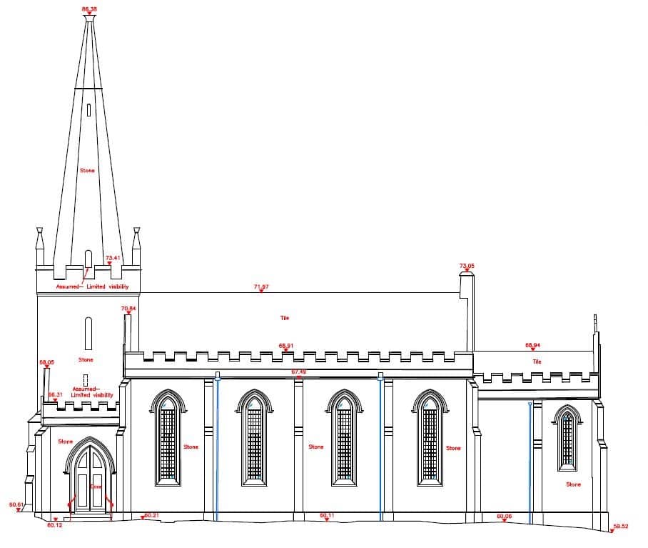
Church elevation drawn in CAD - all from one single measurement
Tutorial
This video will tell you how in just 4 simple steps. All you'll need is a camera, a tape measure and some free to download software.

